Site investigations
Type of resources
Available actions
Topics
Keywords
Contact for the resource
Provided by
Years
Formats
Representation types
Update frequencies
Service types
Scale
Resolution
-
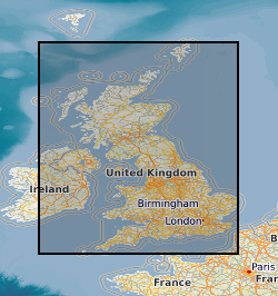
Site investigation and geotechnical data received by BGS from 3rd party organisations in AGS file format. When received by BGS the data is validated against predefined rules, processed and stored in the BGS AGS agnostic store. This data is delivered as received e.g. no interpretative values or observations are added to the data by the BGS. For more details about the Association of Geotechnical & Geoenvironmental Specialists (AGS) see: https://www.ags.org.uk For more details on depositing AGS data with BGS see: http://www.bgs.ac.uk/data/ags To access AGS data held by BGS: http://mapapps2.bgs.ac.uk/geoindex/home.html?layer=AGSBoreholes
-
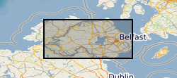
Site investigation and geotechnical data received by the Geological Survey of Northern Ireland (GSNI) from 3rd party organisations in AGS file format. This data has been collected under the Northern Ireland Pan Government Collaborative Framework Agreement (www.bgs.ac.uk/gsni/ags/). Once received by GSNI, the data is validated against predefined rules, processed and stored in the AGS agnostic database store. This data is then delivered as received e.g. no interpretative values or observations are added to the data by the GSNI. For more details about the Association of Geotechnical & Geoenvironmental Specialists (AGS) see: https://www.ags.org.uk
-

Three borehole logs are presented that describe the material excavated from a slag deposit in Consett Co. Durham (ad pdf files). The boreholes were created by GeoSonic Ltd commissioned by Cardiff University in September 2017 as part of a UKRI funded project that explores CO2 uptake in slag. The drilling penetrated through 20 and 25m of material representing the extent of the heap to underlying natural ground. The methods used and samples recovered are described in Pullin et al., 2019 Environmental Science and Technology. 53 (16) 9502-9511. DOI: 10.1021/acs.est.9b01265. The deposited data include photographs of recovered material from one of the boreholes.
-
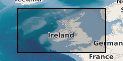
This is the collection of cores and samples held by BGS for the sea areas around the UK. It includes material collected by BGS during its mapping projects and material donated to BGS by other organisations. The main core and sample types are grab samples (sea-bed), gravity cores, vibrocores and rock-drill cores (up to 6m in length), and borehole cores (up to 274m in length). The sea-bed grab samples are Holocene sediments present at the sea-bed and are stored in plastic jars. Where possible, sub-sample material has been retained after analysis. The bulk of the cores consist of Holocene and Pleistocene material. The rest are of bedrock ranging in age from Neogene to Pre-Cambrian. A lot of the core was collected in plastic liner tubing and the unlithified cores have been split vertically. The bulk of the material was collected in the late 1960s, 1970s and 1980s and early 1990's with ongoing additions of new sample and cores each year. The distribution is very variable, but, in general, there are grab samples and/or shallow cores spaced about every 5 - 10km across the entire UK Continental Shelf. In some localised areas the sampling density is much higher. The samples and cores are applicable to a wide range of uses including environmental, geotechnical and geological studies.
-
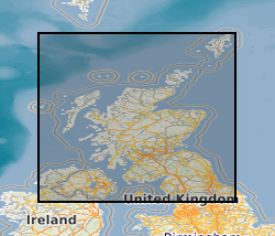
The collection of over 19,000 site investigation reports for Scotland and Northern England consists of records of boreholes, trial pits, geotechnical results and interpretative reports acquired from various sources. The collection started c.1960 to cater for the increasing amount of post-war shallow drilling for building and road construction which was kept separately by the Survey from the Borehole Journal collection reserved for deeper geologist examined mineral bores. The site investigation reports are available for consultation on microfilm. Only the factual parts of reports are available for public inspection. Reports for Northern England are held in the Shallow Borehole File (SB), now no longer added to. All site investigation reports (except SB files) are indexed on the Land Survey Record Index (LSRI) and all boreholes and trial pits contained in the reports (those with adequate site plans) are indexed on the Single Onshore Borehole Index (SOBI).
-

This data pack contains information from geotechnical and contaminated land investigations carried out at potential sites for the development of the UK Geoenergy Observatory in Cheshire. Following these investigations, a decision was made to move the proposed observatory to Thornton Science Park. None of the sites discussed in this data pack are in scope for development as part of the Cheshire Observatory. In total 16 holes were drilled using a variety of techniques. The only hole to be drilled using rotary coring was BHA-101. This borehole was cored extensively and logged with wireline geophysical tools. As such this is the main focus of the data pack. BHA-101 was drilled to TD of 121.2 m between 19-Nov-2020 and 09-Dec-2020. Drill core was collected from 51 m – 121 mm with 100 mm diameter. This initial data release pack from BGS contains composite and digital wireline logs alongside daily driller's borehole records.
-
Reports of site investigations produced by external organisations carried out for all forms of site investigation The reports date back to the 1950s and may contain information on boreholes, trial pits, laboratory tests and chemical analyses etc. The collection covers the whole of Great Britain with concentrations in urban areas and transportation routes. The interpreative parts of the reports are not available to public.
-
New acquisitions of all forms of geological data received from external organisations are recorded in the accessions database and the digital or analogue data itself is then available to users. Data is in the form of reports, plans and digital information. This information comes from a wide variety of sources, including public bodies and agencies and commercial organisations. The data itself will be incorporated into existing corporate collections or may form a new collection in its own right. The rate of transfer will depend on priorities and requirements of both internal and external users. Data is continuously removed from the collection, all except recently received material will have been processed.
-
Index to reports of site investigations produced by external organisations carried out for all forms of site investigation. The Oracle index was setup in 1988 and covers the whole of Great Britain, all site investigation reports are indexed but the level of detail in the index for each record may vary. The reports date back to the 1950's and may contain information on boreholes, trial pits, laboratory tests and chemical analyses etc.
-
The Land Survey Record Index was set up c.1988 to provide a digital database index to records and archives held by the Land Survey in Scotland and Northern England and contains over 46,600 records. Finding aid to the following record groups/data sets, is provided through a application query interface: Site Investigation Records (SE); Land Survey Archives (LSA); Land Survey Records (LSR); Mineral Resource Records (MR); Additional Information Files (AI); Enquiry Record Files (EE; EN); Opencast Coal Sites (OC).
 NERC Data Catalogue Service